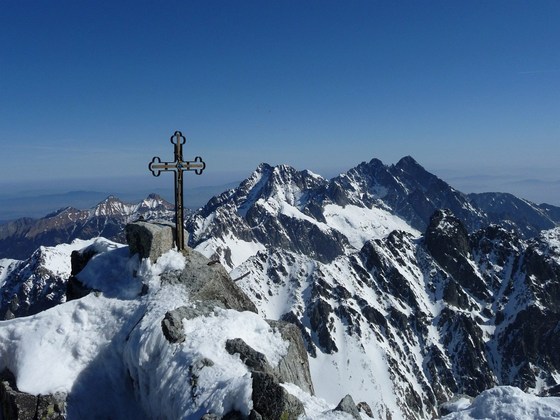


Gerlach Peak (colloquially Gerlach) is the highest peak of the Tatra Mountains, Slovakia and the entire Carpathians. The name is derived from the village of Gerlachov, above which it is situated and belonged to its cadastre. It lies in the south-eastern fork of the Zadní Gerlach Peak, from which it is separated by the Gerlach Saddle. From the top, the ridge continues to Kotlový štít, where it branches off and creates the well-known Gerlach Cauldron. Gerlach Peak is one of the most visited peaks due to its height, accessibility and beautiful mountain scenery. Measurements of the height of the Tatra peaks date back to 1763, when the Viennese court ordered the so-called Josephine mapping. Josephine mapping, i.e. cartographic processing of the entire Habsburg monarchy. They were carried out by military surveyors under the leadership of Waldauf and Fleischer, but their results were not published. Apparently on the basis of these measurements, in 1780 it was stated in the work “Geographie des Königreichs Ungarn” that the highest peak of the entire Tatras is Kriváň. The same conclusion was reached in 1788 by the Bratislava mineralogist Ján Fichtel, who estimated the height of Kriváň at 3,800 m above sea level. m.. The English traveler Robert Townson considered the highest peak of the Tatras to be Lomnický štít. Even scientists in the 19th century, including the famous Swedish botanist Göran Wahlenberg, did not correctly determine the height of the Tatra peaks. They listed Lomnický or Lední štít as the highest. Gerlach was only in fourth place with his height. In 1837 and 1838, Ľudovít Greiner, director of the Jelšava Forest Administration of the Koburg estate, made measurements of the Tatra peaks. Only he correctly found out that the highest peak of the Tatras was Gerlach. However, the public did not accept Greiner’s information. This happened only in the 70s of the 19th century.
Back to map
Cable cars and peaks
High Tatras – Gerlachovský štít
Location photos
Explore the location